Saturday, November 30, 2013

Rounding Out November

We have ended the 11th month of the year on a rather mild note, with a high temperature of 50°---just about 9° above average!  Not too shabby.  Here's a look at some stats from the month.

The warmest high temperature of the month occurred on November 17th at 71°.  The coldest high was 11/23 with a high temperature of 25°.  The coldest temperature of the month occurred on the morning of November 24th, where the low temperature was just 8°.

As far as precipitation goes-- we saw 1.22" of liquid equivalent (rain & melted snow).  That's 1.34" below the normal amount of 2.56".  We also saw a little snow;  0.60" worth which fell on Nov. 11th, with a trace being recorded (at QC Int'l) on the 22nd and 25th.

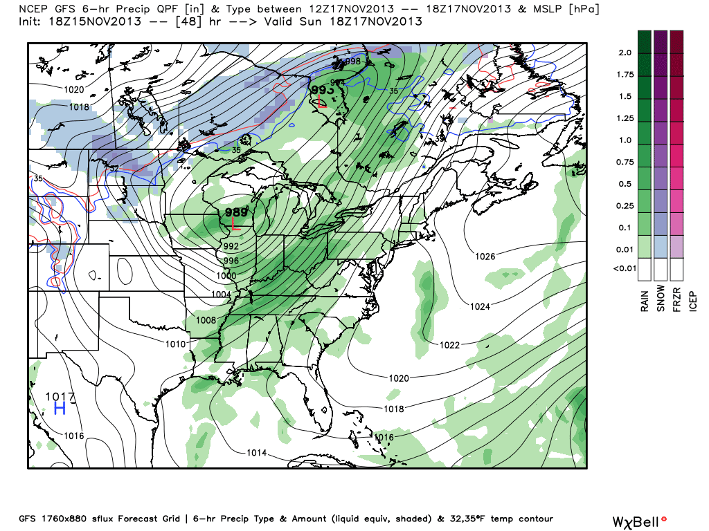
And of course we can't forget about the deadly severe weather outbreak that occurred on our 71° day, Nov. 16th.

  Hundreds of severe weather reports came in that day, including the powerful EF-4 tornado (winds of 190mph) that struck the town of Washington, IL.  As you can see, many parts of the Midwest and Ohio River Valley were affected by severe weather that day.  When the temperature is 71° in November, you know the weather is going to be active.


Friday, November 29, 2013

Comet ISON...It's Alive!

You might have heard about Comet ISON by now, it's been in the news quite a bit over the last 48 hours or so.  The comet promised to make for quite a show in December, if it survived it's (relatively) close call with the sun this week.  First reports indicated the comet burned up and fizzled out, but now it appears the comet (at least part of it) has survived!  It passed within about a million miles of the sun on Thanksgiving and looked like it burnt up completely.  Now it appears part of the nucleus is still intact...I'll wait for more word from NASA and other astronomers to see if we can still count on a nice comet light show in December! 

Here are links with more info:

New York Times

CNN

Earth Sky

Thursday, November 28, 2013

Thanksgiving Weather & A Look Back

Happy Thanksgiving to you and yours!  I hope you have a great one. 

The weather in the Quad Cities today will feature a sun and high cloud mix and highs in the mid-30s.  Looking back at the climate data, here are some interesting Thanksgiving stats:

Average highs:  42°-45°.  The warmest Thanksgiving was back in 1966 when it reached 66°.  The coldest was Thanksgiving 1950 when we dropped to 3°.

53% of Thanksgivings have highs between 33°-49°.

The wettest Thanksgiving was in 1915 when 1.90" of rain fell and the heaviest snow on Thanksgiving was in 1968 when 5" accumulated.  However, there was 8" of snow on the ground on Thanksgiving 1975.

Last year, the high reached 63° in the Quad Cities on Thanksgiving and we had 0.05" of rain.  The last time it snowed (1.3") on turkey day here was in 1993.

Here are some other forecasts for this Thanksgiving.  Enjoy your feast!


CBS4 Meteorologist Anthony Peoples


Wednesday, November 27, 2013

Comet ISON Update

NASA 
Way earlier this year I mentioned the comet ISON and how we could be in for a good show later this year...and here we are "later this year" and the show is still not a slam dunk sure thing.  The next 24 hours will be telling though as the comet zips past the sun.  If the comet burns up we'll end up with basically nothing to look at...if it holds together then we could be in for quite the show in December!  For more read this story from the USA Today, and cross your fingers if you're into this type of thing! 

Click Here

And a link to the blog post from January 3, 2013!  Click Here


Happy Thanksgiving from the Team to Trust!


We hope you have a happy and safe holiday weekend...if you're sticking around close to home the weather looks chilly but overall not too bad!  Things were pretty nasty along the East Coast over the last 48 hours but the weather there should be improving overnight tonight into Thanksgiving afternoon.  Hopefully the winds stay down enough and we can all watch the parade from New York City on Thanksgiving! 

I have an update on the Thanksgiving forecast tonight on Ten at 10 and Anthony is in first thing on Thursday morning with an update on CBS4 News this Morning.  In the meantime, here's a promo the 3 of us shot earlier this week, eventually we'll have some more wintry weather to talk about (maybe as soon as late next week!)

Tuesday, November 26, 2013

A "Turkey" of a Storm to the East

A few snow flurries or snow showers are possible in the Quad Cities Tuesday and, again, Thanksgiving morning.  However, at this point, we don't have to worry about accumulations.

That is not the case to our east as millions prepare to travel for the holiday.


"Winter Storm Warnings" and "Winter Storm Watches" cover much of the eastern part of the country where 6"-18" of snow could fall by Thanksgiving.

If you're traveling east or having company coming in from that direction, check the latest weather forecasts and flight delays.

CBS4 Meteorologist Anthony Peoples

Monday, November 25, 2013

Light Snow To Kick Off The Week

After the coldest morning of the fall season Sunday in the Quad Cities at 8°, we're seeing a little light snow to kick off Thanksgiving week.


That is the radar from this morning showing the heaviest snow to the north of the metro area.  As a matter of fact, over north-central Iowa, there were 3-5" snow reports!


However, amounts in the Quad Cities and to the south should be less than one inch.  All of the snow should be east of us by midday Monday.

Another shot of cold air comes in Tuesday and we could see see some afternoon snow showers with that.

CBS4 Meteorologist Anthony Peoples

Sunday, November 24, 2013

Light Snow Monday

The big story this weekend was the very cold weather.  Lows Sunday morning dropped into the single digits, with wind chills below zero!  While we will still be well below average for much of the work week, it won't be as cold as this weekend.  And, we add snow to the cold on Monday!

RPM simulated radar reflectivity for 8am Monday
This is not expected to be a widespread, heavy snow event.  This disturbance doesn't have much moisture to work with.  But, as you can see from the darker shades of blue, there could be a couple areas with moderate bursts of snow.  Those are areas that could see a little over an inch.
Folks south of Interstate 80 may escape this system with nothing worse than a dusting of snow.  Here in the Quad Cities metro area, I'm thinking a good quarter to half inch of snow is a good bet, with areas north of Highway 30 receiving up to an inch.  Again, we can't rule out a few isolated areas getting 1.5" to 2."  Overall, a weak system.  Just take it slow if you're out on the roads as visibility may be down at times.

Saturday, November 23, 2013

Coldest Air of the Season

You do not need a meteorologist to tell you it's COLD!  But, you may need one to tell you how long it's going to last.  I have that answer:  A while.  Normal highs for this time of the year should be in the middle 40s.  Next weekend is the earliest chance we get at cracking 40°!  These are the coldest November temperatures the Quad Cities have seen since 1995!

In fact, 6 to 10 days out still looks cold.  Here's the Climate Prediction Center's thinking:
Temperatures will be right around 0° in areas north of the Quad Cities such as Maquoketa, IA; Galena, IL; and Mt. Carroll, IL.  Elsewhere temperatures will be in the middle to upper single digits---nearly 20° below average.  Highs Sunday will remain about 20° below average as well.

Sunday night will be much warmer due to southerly winds as high pressure moves out of the area.  This is all ahead of the next disturbance that will make its way through the area Monday bringing a chance for light snow.  At this point, accumulations look light, with the best chance of accumulating snow (up to 1") look to be north of Interstate 80.  CBS4 will keep you updated!

Thursday, November 21, 2013

Thanksgiving Weather -- One Week Out

The countdown to Thanksgiving is on and it's just one week away.  I'm so ready to feast on turkey and all of the good things that come along with it.  (Here's my turkey from last Thanksgiving!)


As of right now and you know this is subject to change, the days leading up to Thanksgiving and all of the travel look pretty good.

My CBS4 10-day forecast features highs in the 30s and lows in the teens and 20s for the week of Thanksgiving.  (The average highs in the Quad Cities for the last week of November are in the low-to-mid- 40s and lows typically drop to the mid-to-upper-20s).

And, NOAA's Climate Prediction Center agrees.


That is the temperature forecast for November 26-30, 2013, and here is the precipitation forecast for the same time period.


If this holds true, we'll be dealing with a cold Thanksgiving.  But, we won't have to contend with a major winter storm!  Stay tuned.

CBS4 Meteorologist Anthony Peoples

Tuesday, November 19, 2013

A Cold Weekend Coming Up

Have you seen the forecast for this weekend?  IT'S COLD!  We'll see highs in the upper 20s and lower 30s Saturday and Sunday...that will be the coldest weather of the season so far.  And it'll be the coldest weekend we've had so far this season by a long shot!  Hopefully you've noticed the stretch of nice and mild weekends we've had...

Oct 5, 6       75/54
Oct 12, 13   71/67
Oct 19, 20   56/63
Oct 26, 27   54/57
Nov 2, 3      51/54
Nov 9,10     60/49
Nov 16, 17  61/71

Once you do the math you'll see the average Saturday high over the last 7 weeks is 61.1 and the average Sunday high has been 59.3!


And this weekend looks like this for high temps:

Nov 23, 24   28/30


Once you do the math you'll see the average Saturday high over the last 7 weeks is 61.1 and the average Sunday high has been 59.3! 

Changing Weather Later This Week

November temperatures in the Quad Cities have recovered some thanks to the 71° high Sunday.  Highs today around 50° are still above average for this time of the year.  However, some big changes are on the way by this weekend.


Light rain is likely tomorrow and tomorrow night, but rainfall amounts will only be around 0.10-0.25".


A wintry mix develops Thursday night and this will likely change over to light snow Friday.  Some LIGHT accumulation is possible and the CBS4 weather team will be monitoring this and bring you the very latest.

This weekend will be very cold with highs only in the 20s to near 30° and overnight lows Saturday may drop to around 10° in some of our hometowns.

CBS4 Meteorologist Anthony Peoples

Monday, November 18, 2013

Cold Weather on Tap for the Quad Cities

After a mild Tuesday things will be turning sharply colder just in time for the weekend...highs this weekend will barely hit 30°!  And that's not the worst of it, on Saturdya night we'll dip into the lower teens for the first time in a long time!  Look at 2 of the main forecast models, the GFS has our temps way down in the teens, while the Euro takes our lows into the single digits, with below zero readings in portions of Iowa!  The Euro is also putting down a few inches of snow around the Quad Cities, which would lead to the colder temps.  While we could see a mixture of rain/snow later this week, significant accumulations are not likely!


GFS model forecast


Euro low temps Sunday morning


More than likely you've seen a lot of the devastation of Sunday's tornado outbreak across Illinois and Indiana.  Here's a new video I came across tonight...It looks like a tornado went right over a car on I-57 in Illinois.  This is yet another scary video of a day many people won't soon forget!

And as of 9pm on Monday night here's a look at the storm reports from the Storm Prediction Center on November 17th...


Sunday, November 17, 2013

Severe Weather Wrap-Up

What a day of weather for the Quad Cities.  The day started with temperatures in the upper 60s to low 70s with gusty southerly winds.  This all ahead of a cold front, and coupled with plenty of energy from the jet stream we were in a perfect set-up for a severe weather outbreak.  Here are some local storm reports:
Some storm reports on 11/17
Muscatine saw the largest hail in the area, the size of golf balls (1.75").  The airport in Sterling had a measured wind gust of 70mph!  Several other reports of 60mph+ winds and pea to quarter size hail were reported across the area.

The main area of devastating severe weather was southeast of the Quad Cities where you see the red triangles.  Those indicate where a tornado was reported, and there were a couple very strong, and unfortunately deadly tornadoes.  One of which hit the town of Washington, IL.  Here is a picture from Alexandra Sutten from our sister station WMDB 31 in Peoria.  This was the scene shortly after the tornado.
As we head into the next couple days we will have a better idea of just how many tornadoes occurred, and we'll learn how strong they were as National Weather Service storm surveyors venture out and assess the damage.

Saturday, November 16, 2013

Weekend Weather Update

It was a warm and windy day in the Quad Cities as a warm front lifted northward, ushering in winds of 20 to 30 mph with temperatures in the low 60s and dewpoints in the 50s!  When it's that warm and dewpoints are that high in November, something's up.  That something is a very strong, tightly-wound low pressure system (developing in Colorado Sat. night) with a cold front that will move through late Sunday morning/early afternoon.

Throughout Saturday night we'll see a piece of energy from the low level jet stream push in from the south west that will increase showers & t'storms after midnight.  SPC has the QCA under a slight risk for golfball size hail and high winds late tonight into tomorrow morning.  As the cold front moves through by midday Sunday, the severe threat shifts east where conditions are more favorable for severe weather.  Here are a couple screen shots of simulated radar reflectivity from the RPM model.

Effective 5am--model shows storms entering southern hometowns
Effective 1pm Sunday--cold front moves off to the east taking severe threat with it

Main QC threats: Strong winds & hail.  Isolated tornado can't be ruled out.  Greater tornado threat East
Once the cold front moves through, we could possibly see a few wrap-around showers in the afternoon hours, but the big stories tomorrow afternoon will be the falling temperatures (low 60s early--into the 40s by late afternoon) and very strong winds.  As I mentioned, this is a very tightly packed system, so as it treks east we'll see sustained winds from the WNW 25-35 mph, and could see gusts 40-45 mph+ at times.
For that reason, a Wind Advisory runs from 10am to 6pm.
Sunday 11/17
As always, you can watch the latest loop of the HD Radar with warnings at www.whbf.com/weather!
Stay weather aware.  Now might be a good time to download the CBS4 ap!

Friday, November 15, 2013

Severe Weather Chance this Weekend

The focus of the forecast tonight on Ten at 10 will be warm and wet weather for the weekend!  How warm?  Highs will be about 15° above normal as we reach the low to mid 60s on Saturday and Sunday.  How wet?  Most of us will have between .25" and .75" of rain this weekend.  There could be some higher totals though in places that see some convection (t'storms) mixed in. 

About the t'storms - the best chance for storms is late Saturday evening and night in the Quad Cities.  At this point in time we'll see relatively muggy air in place and the cold front will still be off to the West.  By Sunday afternoon that front works through the Quad Cities and displaces the svr threat to our East.  The overall chance for severe weather sits at about 20% for Sat. night...

Hail threat Sat. night

Saturday night severe threat

Sunday storms push East

Cold front moving through the area Sun PM
Something else you'll notice this weekend - with a powerful fall storm rolling through the Midwest the pressure graident will be tight. That's thanks to the storm (low pressure) deepening as it rolls through the area and high pressure follows it up on Monday. Expect gusty winds out of the SW Saturday turning to the NW on Sunday! 

Wet & Warm Weekend

Mild temperatures in the low-to-mid-60s are forecast this weekend.  However, we'll have to pay a price for the warmth.  Rain is likely Saturday and Sunday with thunderstorms Saturday night and Sunday.


Rainfall amounts of one-half to one inch are expected with this storm.  There could isolated higher totals where the stronger thunderstorms develop.

For the year, our precipitation total is at 37.31".  The annual average in the Quad Cities is 37.96", which means we're only 0.65" away from where we should be for the entire year and we still have 1.5 months to go in 2013!


While thunder is possible, severe storms are not expected across the Mississippi and Illinois Valleys.  That should occur in downstate Illinois and to the east.

CBS4 Meteorologist Anthony Peoples

Thursday, November 14, 2013

Drought Still A Problem, But Getting Better

The recent rains and light snows across Iowa and Illinois are helping with the drought situation, but both states still need much more moisture as we head into winter.


Across Iowa, 79% of the state is still "abnormally dry", but this is down from 89% last week.  55% of Iowa is still experiencing a "moderate drought" (yellow shading), which is down from 68% last week.

22% of Iowa is still under a "severe drought" (tan shading).  This is down from 27% last week.

Here's some more good news.  Last week, 2% of Iowa was listed under an "extreme drought" and that has dropped to zero.


In Illinois, the drought situation is present, but it's not as bad as Iowa.

74% of Illinois is still experiencing "abnormally dry" conditions, which is basically the same as last week.

A "moderate drought" (yellow shading) still covers 25% of Illinois, but that is down from 38% last week.

3% of Illinois is under a "severe drought" (tan shading).  Last week, that number was at 7%.

A decent rain maker is coming in this weekend and that will help those numbers drop even more when the next update comes out a week from today.

CBS4 Meteorologist Anthony Peoples

Wednesday, November 13, 2013

Iowa Tornado Count in 2013

Now that we're heading into the cold weather season and the threat of tornadoes is winding down, preliminary numbers of twisterrs in Iowa is much lower than average.

As of today, only 26 tornadoes were reported in the "Hawkeye State" in 2013.  The 30-year average is 47.

In eastern Iowa, we saw three tornadoes. 

Two EF-1 tornadoes with winds around 95 miles-per-hour were reported on May 30, 2013.  One was near Conesville, Iowa, and the other near Andalusia, Illinois, in Scott County.


The final tornado (damage pictured above) was on June 24, 2013, about 2.5 miles northwest of Muscatine, Iowa.  It was an EF-1 tornado with winds around 90 miles-per-hour.

Sadly, one man died in that storm and that marked the only tornado fatality in Iowa in 2013.

CBS4 Meteorologist Anthony Peoples

Tuesday, November 12, 2013

Two Measurable Snows Already This Fall

We're only two months into fall and winter is more than a month away, but the Quad Cities has already picked up its second measurable snow of "Winter 2013-2014".

The first, 0.4", fell back on October 22nd and yesterday's official total in the Quad Cities was 0.6".


This is how the snow looked from our SkyCam early Tuesday morning along the Mississippi River in Rock Island, Illinois.

Looking back over the past five years, only November 2011 had already recorded a measurable snowfall.  That year on November 9th, 0.3" fell and that was the only measurable snow that month.

In 2008 and 2010, the first measurable snow of the season didn't fall until November 30th.  In 2008, 3.9" accumulated in the Quad Cities and in 2010, 0.3" fell.

In 2009, the first measurable snow of the season fell on December 7th (0.8").  While we had to wait until December that year, that first snow was part of a three-day snow event that eventually dropped 9.2" of snow from December 7-9, 2009.

And, last year, our first measurable snow waited until almost Christmas.  On December 20th, 4.9" of snow accumulated.

CBS4 Meteorologist Anthony Peoples 

Monday, November 11, 2013

Snow totals on Veterans Day

Here's a quick look at some of the snow totals from Monday...most of the area picked up around a half an inch up to 1 inch!  It's our 2nd accumulating snow of the season already!


November 11th Storm

It was one for the record books for a lot of cities in the Midwest...November 11th, 1911!  It's been more than a hundred years now since The Great Blue Norther set record highs and lows, in the same cities in a few cases.  In the Quad Cities the temperaure plummeted from the mid 70s to the mid teens by midnight...with some rain and snow mixed in for good measure.  The big storm even spawned a tornado just West of Davenport, IA!  If you're into this sort of thing check out the storm on Wikipedia!

http://en.wikipedia.org/wiki/The_Great_Blue_Norther_of_11/11/11

Light Snow & Much Colder Today

I hope you liked the warmth this past weekend and that you got outside to enjoy it. 

Kerry Riley and her family in Geneseo, Illinois, did and took time to share this nice picture.


Big changes are on the way later today and tomorrow!

A strong cold front will drop our temperatures from the upper-40s this morning to around 30° this afternoon.  And, the winds will start to howl out of the northwest at about 30 mile-per-hour.  This will give us wind chills in the teens.


In addition to the colder temperatures and the wind, light snow is likely.  However, accumulations will be under one inch.

After a couple of nights with lows in the teens, moderating temperatures are on the way and by the weekend, we'll see highs in the 50s with some rain showers.

CBS4 Meteorologist Anthony Peoples

Sunday, November 10, 2013

Veterans Day Chill

After seeing temperatures near 60° on Saturday & near 50° on Sunday, we are in for a BIG change in the Quad Cities.  A strong cold front will sweep through the area on Monday, meaning our forecast high of 43° will occur during the middle or late morning hours and plummet during the afternoon.  Combine that with gusty northerly winds, wind chills will be down in the teens!
7 Day Forecast (valid 11/10/13)
As you can see, there is a chance to see some light rain and snow showers along with the passage of the cold front.  Ahead of the front there is a chance for a few light showers, but once the front passes, we could get in a period of light snow.  In fact, a few models are bringing a band of light snow in during the early afternoon hours.
WSI RPM model valid 2 p.m. Monday
The precipitation should be out of the area by the evening hours, with accumulations on grassy areas of a half an inch or less (if any). We'll start to see a decrease in the clouds Mon. night as a very strong area of Canadian high pressure settle into the area, meaning COLD, COLD, COLD.  Temperatures Monday night and Tuesday night will dip down into the middle teens to lower 20s area wide, leaving high temps barely making it above freezing on Tuesday!

Saturday, November 9, 2013

Super Typhoon Haiyan Devastates Philippines

Super Typhoon Haiyan made landfall around the center islands of the Philippines.  The category 5 cyclone packed sustained peak winds of 195mph at one point.  Weather officials say the storm packed winds of 147mph at the time of landfall.  "Haiyan" is the fourth typhoon to hit the islands this season.  The storm also impacted areas directly affected by a magnitude 7.1 earthquake back in October.
Courtesy: National Oceanic and Atmospheric Administration
Thousands are feared dead across the Philippines due to Haiyan's wrath.  It's hard to get an exact number due to the lack of a way to communicate (i.e. computers, cell phone, telephone).  Once communication venues are restored, the death toll is expected to rise.  Many of these deaths are expected to be from flooding after nearly a foot of rain fell in some areas, as well as collapsed buildings.  The nation's disaster agency reports that nearly 4 millions people were evacuated before the storm hit.

While the storm has weakened just a little bit, it's still a very strong cyclone churning in the South China Sea and is expected to brush parts of Vietnam in the next couple of days.  Vietnamese officials have evacuated nearly 500,000 people from "high risk" areas to buildings that are more able to withstand the destructive winds.

I expect more bad news & pictures coming from overseas in the coming days, unfortunately.  For more on the storm and to see some of the damaged areas, click this CBS story.

Friday, November 8, 2013

Coldest Air of the Season

A great weekend is expected across the Quad Cities with highs Saturday approaching 60°.  It will be cooler on Sunday and Monday before the really cold air arrives early next week.


The way things stand now, much colder air comes in Monday night and Tuesday, along with the possibility of some light snow or flurries.  Little, if any, accumulation is expected.

The big story will be the coldest air of the season with highs Tuesday and Wednesday in the 30s and morning lows Wednesday could be in the teens!

Andy will have the very latest on this tonight at 5, 6, and 10 and Kyle will continue to update us on the cold and light snow potential this weekend.

CBS4 Meteorologist Anthony Peoples

Thursday, November 7, 2013

Next Week's Weather Update

If your hopes are up for a lot of snow next week in the Quad Cities, I'll try to let you down easy with this blog update... While we do have the chance for some snow late Monday and Tuesday any totals look to be very light and by far the biggest weather story will be to cold temperatures!  Highs will range from 15 to 20 degrees below average!  With a normal high in the lower 50s that translates to HIGH TEMPS IN THE 30s! 

Here's a snapshot from the latest run of the GFS - snow totals (very light) and very cold temps!


Very light snow
Tuesday high temps well below normal
 

Wednesday, November 6, 2013

Nearing Our Yearly Precipitation Average

Our latest rain event is beginning to wind down and by Wednesday afternoon, we'll see a mix of sun and clouds.

The downside is that afternoon temperatures will only be in the 40s and northwest winds at about 20-30 miles-per-hour will definitely put a chill in the air.


These are the rainfall totals (as of 9 a.m. Wednesday) from yesterday and this morning.

While Davenport got more rain than Moline, this rain brings our yearly precipitation total at Quad City International Airport to 37.26", which is now just 0.70" shy of the yearly average.

CBS4 Meteorologist Anthony Peoples

Tuesday, November 5, 2013

Update on Tuesday Night Rain

Here's a quick update on rain potential for Tuesday night...we're still on track for rain tonight and models indicate anywhere from around a half an inch of rain up to just under 1 inch of rain in the Quad Cities.  All the rain is developing around a cold front that will work through the metro area by around 10am, effectively ending all of the moderate rain.  Here are 2 model forecasts for rain totals...


As I check the radar and the rain's development this evening it looks like totals will end up closer to the lower end of this range.  Count on anywhere from a quarter to a half an inch around the Quad Cities.  This will push us closer to the annual average rain total in the Quad Cities (thanks to our very wet 1st 6 months of the year) as Anthony mentioned in the blog earlier this week!

Finally, it is a strong fall storm and ahead of the cold front winds will stay gusty tonight out of the South...here's a Special Weather Statement from the NWS in Davenport this evening:

...STRONG WINDS AFFECTING THE AREA THROUGH LATE EVENING...

SOUTH WINDS AHEAD OF A STORM SYSTEM WILL CONTINUE THROUGH
MIDNIGHT. THESE WINDS WILL BE SUSTAINED AROUND 20 MPH TO 25
MPH...WITH GUSTS TO NEAR 40 MPH. BE PREPARED FOR STRONG SOUTH WINDS
IF TRAVELING.

Monday, November 4, 2013

Next Rain May Push Us Close To Our Annual Average

As of today, 36.82" of precipitation (rain and melted snow) has accumulated in the Quad Cities in 2013.  This is only 1.14" shy of what is considered average for a calendar year.

Another soaking rain is on the way to the area Tuesday and Wednesday.  Here's the latest CBS4 projection on rainfall amounts.


This will bring us very close to our average annual precipitation.  However, that is very deceiving considering 21.32" of that total fell in the April, May, and June.  Meanwhile, only 1.72" fell in August and September.

CBS4 Meteorologist Anthony Peoples