Thursday, March 31, 2011

Clouds and Light Rain for Friday


The clouds have moved in after a very sunny and nice Thursday afternoon. These clouds are associated with a system just off to our west that will produce some light, scattered rain showers for tonight and for your Friday morning. These clouds will keep our temperatures from dropping into the 20s. Most of us will be in the low to mid 30s overnight Thursday. Enjoy your Friday!

Wednesday, March 30, 2011

Not a Bad Day...


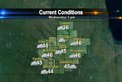
It's not too bad of a day in the QCA. Most of us have sunny skies, with temps near 50°! The normal high is up to 55 as of today, but sunshine and upper 40s/lower 50s is acceptable to most of us I would imagine! Let us know what you think of today's weather!

Tuesday, March 29, 2011

A Snowy Start...

It was a snowy start to the day South/SW of the QC. 2 spotters reported 2.0" of snow in Washington, Iowa! The snow stayed just South of the QC, as expected! We're now looking for a slight warm-up through the end of the week...

Monday, March 28, 2011

Sunny, but Cold...


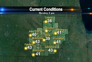
Even with lots of late March sunshine it's still pretty cold outside today! As of 2pm most of our temps are hovering around 40°! The normal high is now up to 54° and it'll be a few more days before things get close to average as far as our daytime highs go! At least it's not snowing much like it is down around St. Louis! They had snow over the weekend and could see another inch or 2 on Tuesday!

Sunday, March 27, 2011

Is Snow in Our Future?


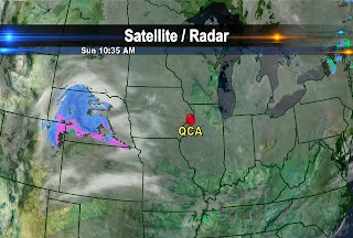
Temperatures on Sunday were rather chilly! We managed to make into the upper 30s to lower 40s today. We will see our temperatures remain rather cool for Monday with more sunshine to begin the week. Now for the big question this week, which is will there be any snow for Tuesday!? Right now it is looking like the snow is going to pass well to our south leaving us with small chance of seeing a few flurries Tuesday evening! The second image is of a weather model (the NAM) that we use to provide us with guidance for when we put our forecasts together. This model is for Tuesday evening at 7 PM CT. The model is showing us that all the precip will stay off to our west and south. The precipitation is indicated by the purples, blues, and greens on the map. There will be another chance for some precipitation this week, but in the form of rain on Friday. Have a great week!

Saturday, March 26, 2011

A Cold, Breezy Saturday in the QC


Our average high for today is 53° and average low is 33°. Apparently mother nature did not get the memo because temperatures this afternoon are in the mid to upper 30s and that is not even factoring in the wind chill! Today winds are sustained out of the Northeast at 10-18 mph. So when you factor in those wind speeds it actually feels like it is in the 20s. Unfortunately, the cold is going to stay with us as we head into Sunday and into the middle of next week. It is looking like we will have to wait until next Thursday before temperatures recover to near 50°!

Thursday, March 24, 2011

Flood Update

We're still looking at major to record flooding on the Mississippi River over the next few weeks, however there is a little bit of good news here as far as the eventual crest goes. First, the biggest problem will be from melting snow well North of the QC over the next few weeks. These places picked up additional heavy, wet snows this week. Now for the good news - any additional rain or a rapid warm-up would aggravate what is sure to be massive flooding this spring, and it looks like for the next 6-10 days mother nature should cooperate, and not provide too much rain/snow and warm temperatures. Most of this part of the country can expect below average precip and below average temps late this month and through early April!

Wednesday, March 23, 2011

A Chilly Day


The average high is up to 52° right now...but our temps are heading in the wrong direction! It's blustery out there today and it looks to get even colder later this week. How Cold? Check us out today on CBS4 News at 5 and 10 at Ten, in HIGH DEFINITION!

Monday, March 21, 2011

Severe Weather Threat


Spring is here, and so is our first chance for severe t-storms in the Quad Cities! During the day Tuesday a weather disturbance will roll across Iowa and out ahead of the system there will be the threat for thunderstorms, some of which could be severe during the afternoon and evening hours. Right now it looks like the biggest threat will be from hail and strong winds, but there's also a slight chance for an isolated tornado or 2 through portions of the Midwest on Tuesday! We'll keep you up to speed on CBS4 TV and cbs4qc.com all day long on Tuesday, and all season long too!

Sunday, March 20, 2011

Warmer Temps and Rain...


Spring officially arrived at 6:21 CT Sunday evening! Temperatures suprised everyone on Sunday by climbing into the low to mid 70s for highs. Galena only reached a high of 48° because they were just North of the warm front that enabled our temperatures to climb into the 70s. The average high for this time of year is 50°. Our temperatures were 10-20° warmer on Sunday when compared to Saturday's temps!


In addition to abnormally warm temps, the region experienced rain early Sunday morning and the rainfall amounts varied greatly across the area. The QCA picked up less than a tenth of an inch of rain while Galena measured 0.87 inches of rain. Muscatine also saw a heavier rain shower move through as they had a total of 0.66 inches after Sunday mornings' showers. We will see the threat of showers and thunderstorms continue for Monday evening into most of Tuesday. There is a possibility that the storms on Tuesday could reach severe limits. So stay with CBS4 this week for the latest on the area's forecast.

Saturday, March 19, 2011

Spring Begins with Heavy Rains...


Spring officially begins this Sunday, March 20th at 6:21 PM CT. Unfortunately, we are going to see temperatures take a nose-dive for the mid 30s to lower 40s at the end of the week. On Sunday the QCA could experience its first round of strong thunderstorms for the year. The Storm Prediction Center (SPC), which issues the severe thunderstorm and tornado watches for the entire U.S., has issued a slight risk for severe weather just Southwest of the QCA. Now a slight risk means that conditions could be favorable for some storms to become severe. A thunderstorm is classified as severe when wind gusts are 58 mph or greater and/or when there is hail of one inch in diameter or larger. The main concerns for those in the slight risk area for Sunday is for hail. Despite heavy rains for us in the Quad Cities, it appears most of the severe weather, if it occurs, will be to our Southwest on Sunday. The heavy rains this week will certainly not help those who live along the Mississippi River concerned with flooding, however, the good news is the latest flood river outlook from the National Weather Service (seen below) does not show that flooding is imminent just yet for the upcoming week.

Thursday, March 17, 2011

Closing in on 70!


Muscatine hit 70° earlier today, Fairfield is at 70° now and in the QC we're not too far away! Even with the clouds this afternoon temps are downright balmy all across the area. Unfortunately it won't last long though, expect a bit of a cooldown later tonight!

Wednesday, March 16, 2011

Warmer Temps for Thursday!


It was a great Wednesday to get outside! Temperatures reached the low to mids 60s for most of us in Eastern IA and Western IL. The QCA's official high was 63° on Wednesday. The map shows the highs across the region for Wednesday. Omaha, NE and Wichita, KS made it into the lower 70s today. The warm weather that is affecting the Central Plains right now will work its way further eastward for Thursday. This will allow our temperatures to climb into the upper 60s and even some of us could see our thermometers reach 70°!

Tuesday, March 15, 2011

Snow Melt.....


Here in the QCA we are concerned about flooding and there is still a large amount of snow on the ground to our North in Minnesota and Wisconsin. The image shows the current snow depth in inches for the U.S. You can see that the snow depth in part of Wisconsin and Minnesota are close to 10 inches or more. So we shall see how fast this remaining snow will melt!

Monday, March 14, 2011

Temperature Outlook


This is a 6-10 day outlook for temperatures across the U.S. and it is put together by the Climate Prediction Center. The map is showing that the QCA could be looking at temperatures above the normal average over the next 6-10 days (shaded in orange). Only a small portion of the contiguous U.S. will be near their normal temperatures. This area stretches from the western Dakotas into portions of Colorado, Wyoming, and southward into New Mexico (shaded in white).
While the Western U.S. could be below their average temperature for this time of year (shaded in blue).

Sunday, March 13, 2011

It Was A Cold Sunday Morning....


Temperatures started out in the low to mid 20s today. Galena was coldest location with a temperature of 19 degrees. There is a warm up on the way this week! Our average high for this time of year is 47 degrees. We should see temperatures climb into the 50s and even the lower 60s by mid-week!

Clouds Are Keeping Our Temperatures Down!


Temperatures dropped into the 20s for overnight lows as expected, but we have a deck of low-level clouds that is making it feel rather chilly outside.

Saturday, March 12, 2011

Cold Night Ahead...


It is a rather chilly evening. In our earlier post we talked about the breezy conditions so when you factor in those wind speeds it actually feels like it is in the teens in some locations! Galena's wind chill is 10 degrees as of 9:30 PM!! If you are heading out tonight or early on Sunday be sure to bring the coat along.

A Rather Breezy and Cool Saturday


It was not only cooler today, but the winds were rather gusty. Winds have been sustained out of the Northwest from 15-20 mph with winds gusting close to 30 mph at times! Here are some wind gusts recorded around the area as of 5 PM CT early Saturday evening.

Wednesday, March 9, 2011

More Memorable in February - the Packers or the Blizzard?

Don't forget to vote in the poll on the weather page at cbs4qc.com

What was more memorable during February 2011 - The blizzard or the Packers winning the Super Bowl?

Latest check had THE BLIZZARD at 76%!

Cast your vote by clicking here:
http://www.whbf.com/Global/category.asp?C=5137

Monday, March 7, 2011

Rain on the Way


It's looking more and more like rain from Tuesday night through Wednesday. Most of the area will see upwards of half an inch of rain, with some locations picking up close to 1 inch!

Friday, March 4, 2011

Heading to the Rocks' Game? Expect Rain...


After some scattered showers/thundershowers Friday afternoon we're looking at a more concentrated area of rain arriving Friday evening. Especially from the QC to central Illinois a steady rain with a few embedded thunderstorms is likely. If you're heading out to check out the Rocks, Pioneers or the Maroons vs Panthers hoops tourney games make sure you take the umbrella!

Thursday, March 3, 2011

Rain on the Way...


After a few sunny days in the QC rain will arrive Thursday night or Friday. The showers shouldn't be too heavy in the QC, but the rain will add up to quite a bit East/Southeast of the QC...here's a look at expected rain totals through Saturday afternoon.

Wednesday, March 2, 2011

Another Clear Day


It's been a nice stretch of dry weather through the middle of this week, now though our next chance for rain is taking shape SW of the QC. The chance for showers is set to arrive Thursday night and last through Friday.