
After the first five days of the month, temperatures are running more than six degrees below average with the average June temperature at 61.3°. Here's a little trivia for you: the coolest June on record in the Quad Cities was back in 1916 at 65.8°.
While cooler than average temperatures in the 70s will hold through Sunday, much warmer weather is on the way next week.
Here is a plot of temperatures over the next ten days.
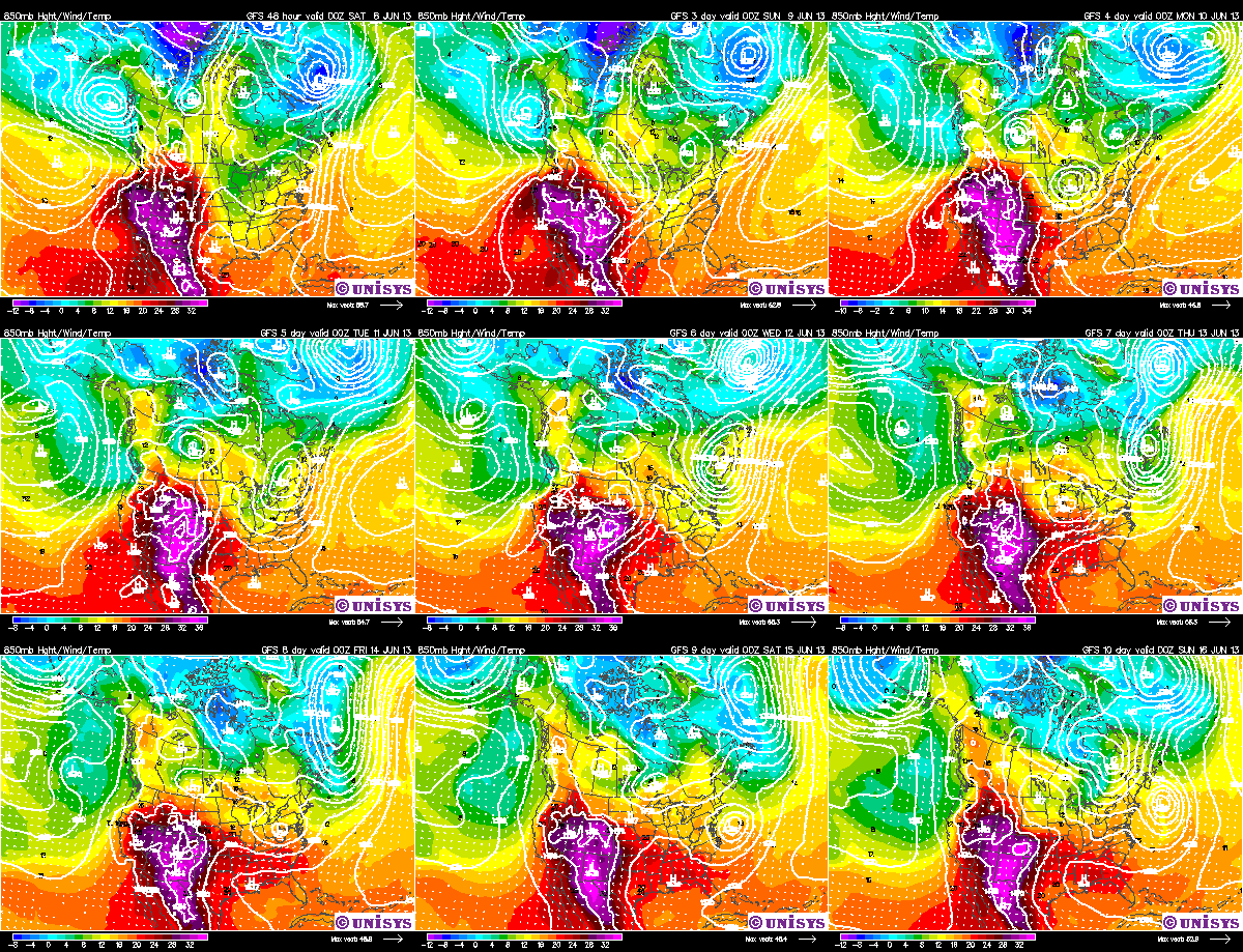
Where you see the purple and red colors, that is where intense heat will be building across the middle part of the U.S. and the Southwest. High temperatures this upcoming weekend and early next week will top 100° in parts of west Texas and 90s will be likely in the Plains.
Meteorologists call this the "ring of fire". That big bubble of heat will be close to the Midwest. If it moves into our area, the forecast highs in the low-to-mid-80s next week will have to be bumped up. On the other hand, if it stays in the Plains, we could be on the outside of that "ring of fire" and have several rounds of thunderstorms that could produce heavy rain, which will cool down the temperatures.
This is definitely something to watch for next week.
Enjoy the rest of your weekend and this weekend!
CBS4 meteorologist Anthony Peoples
No comments:
Post a Comment