Tuesday, May 31, 2011

June Preview


Here are a couple maps from the NWS Climate Prediction Center, meteorologists there are thinking temperatures could easily end up close to normal in June and rainfall could end up above average in the QC...that being said, the forecast looks warm for the first 6-10 days of June!

May Rain


We ended up with more than 5 inches of rain during the month of May...and that's after a very dry start to the month!

Monday, May 30, 2011

A Hot Holiday


Today was one of the warmest Memorial Days we've had in the last 10 years! If you liked the warm weather today you'll be happy to know there's a lot more of it coming up this week!

Sunday, May 29, 2011

Sunday's Storm Aftermath


Here is an update on Storm Reports from across the QCA. There are a two reports of wind damage around Rock Island and a wind gust of 60 mph was recorded at Moline. Another wind gust of 64 mph was recorded at Park View, IA. There are also reports of wind damage in Clinton, IA and Wheatland, IA along with wind damage reports South and East of the Quad Cities.


The storm not only produced strong winds, but also large amounts of rain. In the QCA we had over a half inch of rain. Muscatine and Fairfield received over two inches of rain while Clinton, IA had close to four inches.


The storm that moved through is what meteorologists refer to as a derecho. A derecho is a fast-moving wind storm that occurs with strong to severe thunderstorms. They are most known for strong, damaging straight-line winds that can occur over a hundred miles from North to South and East to West.

Severe Thunderstorm Watch Update

As of 1PM the severe thunderstorm watch was cancelled. If you have any photos of damage send them to weather@cbs4qc.com or post them to our WHBF facebook page. I'll have more weather updates later this afternoon!

Storm Reports as of 12PM

Severe storms are now moving to the east of the Quad Cities. However, the storms left their mark in the QCA. We have had severeal reports of wind damage around the QCA including a tree down in Rock Island, power lines are also down in some areas. There was a wind gust of 60 mph recorded at Moline. A severe thunderstorm watch remains in effect until 4pm this afternoon. I'll have your full forecast tonight at 5 and 10 CBS4.

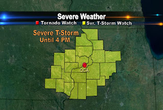
Severe T-Storm Watch Until 4pm


Severe thunderstorms are moving through the area and the entire CBS4 viewing area is under a severe thunderstorm watch until 4pm. Stay with CBS4 News for the latest developments.

Saturday, May 28, 2011

Rainfall Totals Today


Some areas experienced some heavy rain and thunderstorms earlier today. Princeton, IL received almost an inch of rain. Burlington, IA also had some heavier showers move through early Saturday afternoon. Our weather watcher in Altona, IL measured 0.84 inches of rain. All of the rain has moved out of the area right now, but there still is a chance for scattered showers and thunderstorms tonight and for the first half of Sunday.

Chance for Showers and T-Storms


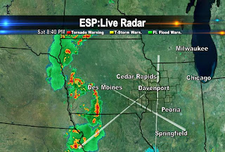
As of 530pm there were two lines of showers and thunderstorms moving East of the QCA. There will be a chance for showers and thunderstorms throughout the night with a slight chance of a strong to severe thunderstorm. The threat of storms lasts into Sunday morning before our skies begin to clear on Sunday afternoon.

Friday, May 27, 2011

First Hand Account from an ER Dr. in Joplin, MO


Click on this blog's title for a direct link to the story. This is an amazing account of what happened for one of the Doctors working at St. John’s Regional Medical Center in Joplin, MO on Sunday, May 22, 2011.

My name is Dr. Kevin Kikta, and I was one of two emergency room doctors who were on duty at St. John’s Regional Medical Center in Joplin, MO on Sunday, May 22, 2011.

You never know that it will be the most important day of your life until the day is over. The day started like any other day for me: waking up, eating, going to the gym, showering, and going to my 4:00 pm ER shift. As I drove to the hospital I mentally prepared for my shift as I always do, but nothing could ever have prepared me for what was going to happen on this shift. Things were normal for the first hour and half. At approximately 5:30 pm we received a warning that a tornado had been spotted. Although I work in Joplin and went to medical school in Oklahoma, I live in New Jersey, and I have never seen or been in a tornado. I learned that a “code gray” was being called. We were to start bringing patients to safer spots within the ED and hospital.

At 5:42 pm a security guard yelled to everyone, “Take cover! We are about to get hit by a tornado!” I ran with a pregnant RN, Shilo Cook, while others scattered to various places, to the only place that I was familiar with in the hospital without windows, a small doctor’s office in the ED. Together, Shilo and I tremored and huddled under a desk. We heard a loud horrifying sound like a large locomotive ripping through the hospital. The whole hospital shook and vibrated as we heard glass shattering, light bulbs popping, walls collapsing, people screaming, the ceiling caving in above us, and water pipes breaking, showering water down on everything. We suffered this in complete darkness, unaware of anyone else’s status, worried, scared. We could feel a tight pressure in our heads as the tornado annihilated the hospital and the surrounding area. The whole process took about 45 seconds, but seemed like eternity. The hospital had just taken a direct hit from a category EF5 tornado.

Then it was over. Just 45 seconds. 45 long seconds. We looked at each other, terrified, and thanked God that we were alive. We didn’t know, but hoped that it was safe enough to go back out to the ED, find the rest of the staff and patients, and assess our losses.

“Like a bomb went off. ” That’s the only way that I can describe what we saw next. Patients were coming into the ED in droves. It was absolute, utter chaos. They were limping, bleeding, crying, terrified, with debris and glass sticking out of them, just thankful to be alive. The floor was covered with about 3 inches of water, there was no power, not even backup generators, rendering it completely dark and eerie in the ED. The frightening aroma of methane gas leaking from the broken gas lines permeated the air; we knew, but did not dare mention aloud, what that meant. I redoubled my pace.

"We had to use flashlights to direct ourselves to the crying and wounded. Where did all the flashlights come from? I’ll never know, but immediately, and thankfully, my years of training in emergency procedures kicked in. There was no power, but our mental generators were up and running, and on high test adrenaline. We had no cell phone service in the first hour, so we were not even able to call for help and backup in the ED."

I remember a patient in his early 20’s gasping for breath, telling me that he was going to die. After a quick exam, I removed the large shard of glass from his back, made the clinical diagnosis of a pneumothorax (collapsed lung) and gathered supplies from wherever I could locate them to insert a thoracostomy tube in him. He was a trooper; I’ll never forget his courage. He allowed me to do this without any local anesthetic since none could be found. With his life threatening injuries I knew he was running out of time, and it had to be done. Quickly. Imagine my relief when I heard a big rush of air, and breath sounds again; fortunately, I was able to get him transported out. I immediately moved on to the next patient, an asthmatic in status asthmaticus. We didn’t even have the option of trying a nebulizer treatment or steroids, but I was able to get him intubated using a flashlight that I held in my mouth. A small child of approximately 3-4 years of age was crying; he had a large avulsion of skin to his neck and spine. The gaping wound revealed his cervical spine and upper thoracic spine bones. I could actually count his vertebrae with my fingers. This was a child, his whole life ahead of him, suffering life threatening wounds in front of me, his eyes pleading me to help him.. We could not find any pediatric C collars in the darkness, and water from the shattered main pipes was once again showering down upon all of us. Fortunately, we were able to get him immobilized with towels, and start an IV with fluids and pain meds before shipping him out. We felt paralyzed and helpless ourselves. I didn’t even know a lot of the RN’s I was working with. They were from departments scattered all over the hospital. It didn’t matter. We worked as a team, determined to save lives. There were no specialists available -- my orthopedist was trapped in the OR. We were it, and we knew we had to get patients out of the hospital as quickly as possible. As we were shuffling them out, the fire department showed up and helped us to evacuate. Together we worked furiously, motivated by the knowledge and fear that the methane leaks could cause the hospital could blow up at any minute.

Things were no better outside of the ED. I saw a man crushed under a large SUV, still alive, begging for help; another one was dead, impaled by a street sign through his chest. Wounded people were walking, staggering, all over, dazed and shocked. All around us was chaos, reminding me of scenes in a war movie, or newsreels from bombings in Bagdad. Except this was right in front of me and it had happened in just 45 seconds. My own car was blown away. Gone. Seemingly evaporated. We searched within a half mile radius later that night, but never found the car, only the littered, crumpled remains of former cars. And a John Deere tractor that had blown in from miles away.

Tragedy has a way of revealing human goodness. As I worked, surrounded by devastation and suffering, I realized I was not alone. The people of the community of Joplin were absolutely incredible. Within minutes of the horrific event, local residents showed up in pickups and sport utility vehicles, all offering to help transport the wounded to other facilities, including Freeman, the trauma center literally across the street. Ironically, it had sustained only minimal damage and was functioning (although I’m sure overwhelmed). I carried on, grateful for the help of the community.

Within hours I estimated that over 100 EMS units showed up from various towns, counties and four different states. Considering the circumstances, their response time was miraculous. Roads were blocked with downed utility lines, smashed up cars in piles, and they still made it through.

We continued to carry patients out of the hospital on anything that we could find: sheets, stretchers, broken doors, mattresses, wheelchairs—anything that could be used as a transport mechanism.

As I finished up what I could do at St John’s, I walked with two RN’s, Shilo Cook and Julie Vandorn, to a makeshift MASH center that was being set up miles away at Memorial Hall. We walked where flourishing neighborhoods once stood, astonished to see only the disastrous remains of flattened homes, body parts, and dead people everywhere. I saw a small dog just wimpering in circles over his master who was dead, unaware that his master would not ever play with him again. At one point we tended to a young woman who just stood crying over her dead mother who was crushed by her own home. The young woman covered her mother up with a blanket and then asked all of us, “What should I do?” We had no answer for her, but silence and tears.

By this time news crews and photographers were starting to swarm around, and we were able to get a ride to Memorial Hall from another RN. The chaos was slightly more controlled at Memorial Hall. I was relieved to see many of my colleagues, doctors from every specialty, helping out. It was amazing to be able to see life again. It was also amazing to see how fast workers mobilized to set up this MASH unit under the circumstances. Supplies, food, drink, generators, exam tables, all were there—except pharmaceutical pain meds. I sutured multiple lacerations, and splinted many fractures, including some open with bone exposed, and then intubated another patient with severe COPD, slightly better controlled conditions this time, but still less than optimal.

But we really needed pain meds. I managed to go back to the St John’s with another physician, pharmacist, and a sheriff’s officer. Luckily, security let us in to a highly guarded pharmacy to bring back a garbage bucket sized supply of pain meds.

At about midnight I walked around the parking lot of St. John’s with local law enforcement officers looking for anyone who might be alive or trapped in crushed cars. They spray-painted “X”s on the fortunate vehicles that had been searched without finding anyone inside. The unfortunate vehicles wore “X’s” and sprayed-on numerals, indicating the number of dead inside, crushed in their cars, cars which now resembled flattened recycled aluminum cans the tornado had crumpled in her iron hands, an EF5 tornado, one of the worst in history, whipping through this quiet town with demonic strength. I continued back to Memorial hall into the early morning hours until my ER colleagues told me it was time for me to go home. I was completely exhausted. I had seen enough of my first tornado.

How can one describe these indescribable scenes of destruction? The next day I saw news coverage of this horrible, deadly tornado. It was excellent coverage, and Mike Bettes from the Weather Channel did a great job, but there is nothing that pictures and video can depict compared to seeing it in person. That video will play forever in my mind.

I would like to express my sincerest gratitude to everyone involved in helping during this nightmarish disaster. My fellow doctors, RN’s, techs, and all of the staff from St. John’s. I have worked at St John’s for approximately 2 years, and I have always been proud to say that I was a physician at St John’s in Joplin, MO. The smart, selfless and immediate response of the professionals and the community during this catastrophe proves to me that St John’s and the surrounding community are special. I am beyond proud.

To the members of this community, the health care workers from states away, and especially Freeman Medical Center, I commend everyone on unselfishly coming together and giving 110% the way that you all did, even in your own time of need. St John’s Regional Medical Center is gone, but her spirit and goodness lives on in each of you.

EMS, you should be proud of yourselves. You were all excellent, and did a great job despite incredible difficulties and against all odds

For all of the injured who I treated, although I do not remember your names (nor would I expect you to remember mine) I will never forget your faces. I’m glad that I was able to make a difference and help in the best way that I knew how, and hopefully give some of you a chance at rebuilding your lives again. For those whom I was not able to get to or treat, I apologize whole heartedly.

Last, but not least, thank you, and God bless you, Mercy/St John’s for providing incredible care in good times and even more so, in times of the unthinkable, and for all the training that enabled us to be a team and treat the people and save lives.

Sincerely,

Kevin J. Kikta, DO
Department of Emergency Medicine
Mercy/St John’s Regional Medical Center, Joplin, MO

Thursday, May 26, 2011

Tornado Video

Here's some amazing video from one of the tornadoes in Oklahoma earlier this week...courtesy of KOCO TV and Youtube.

Wednesday, May 25, 2011

Storm Reports Rolling In...


The storm reports keep rolling in tonight...so far we've seen more than 60 tornado reports and hundreds of hail reports. More than 40 of the hail reports have been for hail MORE than 2 inches in diameter!

Monday, May 23, 2011

Storms Stay South


After a round of severe t-storms Sunday night things are much quieter around the QCA today...but the same can't be said down by St. Louis. Check out the storm reports from Monday so far, a line of severe t-storms with damaging winds rolled right through the St. Louis area this afternoon. It looks like there could be another tornado outbreak in the Plains states on Tuesday!

Sunday, May 22, 2011

Storm Reports


Severe weather moved through the QCA on Sunday producing strong winds, large hail, and even some sightings of a funnel cloud near Davenport. A gust of 64 mph was recorded at Riverdale tonight. There was a report of tornado north of Liberty, IA.

Tornado Watch Until 9pm CT


A tornado watch is in effect until 9 PM CT. A watch means conditions are favorable for a tornado and/or severe weather to develop. A warning is when a tornado is occuring and has been observed on radar or by a trained spotter. A warning is when you seek shelter and a watch means that you should monitor the situation by tuning in to television, radio, or a weather radio to hear if any warnings are issued. So right now we are under a tornado watch until 9pm CT. Stay with CBS4 News for the latest developments.

Sunday Severe Weather Potential Update...


The Storm Prediction Center now has the QCA under a moderate risk for severe weather on Sunday. If storms do develop and become severe the best time frame for development will be between 2pm and 6pm. The severe weather threats include hail, wind, and tornadoes cannot be ruled out. I will be monitoring the situation all day long so stay with CBS4 News and CBS4QC.com for the latest developments.


Saturday, May 21, 2011

Severe Weather Potential


A cold front is slowly progressing eastward towards the QCA. Tonight, (Saturday) the cold front is producing showers and thunderstorms in Central and Western Iowa. There are several severe thunderstorm watches in effect for those areas tonight.


There have been several reports of hail in Eastern Nebraska and Western Iowa.
However, in Northwest Missouri there have been a few reports of some tornadoes. The severe weather threat shifts into the QCA for Sunday afternoon and evening. The best chance for showers and thunderstorms will be between 4pm and 7pm. We are under a slight risk for severe weather on Sunday. If storms are to become severe on Sunday, the main threats will be large hail and strong winds. Stay with CBS4 all day Sunday for the latest weather updates!

Friday, May 20, 2011

Rain Holding Off, So Far...


This evening's rain has held off West of the QC so far, and it looks like our first batch of rain will arrive after midnight tonight...we are still on track for showers and t-storms late tonight and during Saturday morning! Have a great weekend, and take advantage of the limited sunshine coming up Saturday and Sunday afternoon.

Rain Moving In...


Right now most of the rain is still West of the QCA, but it is making some progress toward the East. By late this evening and especially overnight the chance for rain goes up in the QC...and we're still looking at rain/storms off-and-on through the next 5 or 6 days!

Tuesday, May 17, 2011

Storm Update


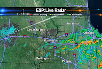
Here's a quick look at our ESP:Live Doppler Radar...note the storm East of Galesburg. Right now that's the worst of the weather but even that storm is not strong enough for a warning as of 3:10pm. The entire area is under a Severe T-Storm Watch until 7pm...and we'll keep you posted if anything stronger pops up!

Update: At 3:09pm there was a wind gust of about 58 mph, which is close to the threshold for a Svr. T-Storm Warning...

Record Low TIED!


Last Tuesday it was a record high in the QC...this Tuesday it's a tie for the record LOW! We dropped to a frosty 35° this morning - now the good news, tonight should not be as cold.

Monday, May 16, 2011

Frost Likely Tonight!


As temps drop to the lower/mid 30s late tonight frost is likely from the QC up to Galena...basically everyone along and North of I-80 can expect an unseasonably cold night! To see what the record low is check us out on 10 at Ten tonight!

SUNSHINE...


We're seeing A LOT of sunshine today, and tomorrow looks sunny too! In the meantime, tonight we could see some frost out there as temps drop in to the mid 30s for a lot of us! If you have some sensitive plants that you want be safe about make sure you cover them up tonight, or bring them in if you can!

Sunday, May 15, 2011

Cool Temperatures Not Only in the QCA


Temperatures across the entire U.S. were rather cool for Sunday. Only Miami was sitting in the 80s as of 5pm. Even Atlanta only reached a high of 62° and their highs should be near 80° during this time of the year.

Drying Out!


The rain is now exiting the region and the sun has returned! In response to the sunshine, temperatures have climbed to near 60° or above as of the 3 o'clock hour.

Saturday, May 14, 2011

Rainfall Totals


Here are the rainfall totals as of 230 pm CT on Saturday afternoon. Princeton, IL has picked up close to an inch of rain from this system. So when will the rain stop? I'll have your full forecast tonight on CBS4 News @ 6 and then again on 10 @ Ten!

Friday, May 13, 2011

Rainy Weekend


It looks like a rainy weekend in the QC. As an area of low pressure pulls away from the QC we'll see rain and cooler temps on the back side of the storm. By late Sunday the rain lets up and sunshine returns Monday...for the rest of next week's forecast check us out on CBS4 News at 5pm or Ten at 10 tonight!

Thursday, May 12, 2011

Rain Chances


While we've had the chance for showers and t-storms over the last 36 hours or so not much has popped up yet around the QC. Our ESP:Live Doppler Radar is quiet again this afternoon as most storms that do develop should stay off to the North, in Wisconsin there is a Svr. T-Storm Watch in effect for most of the afternoon. Later tonight though our chance for showers and t-storms goes up once again!

Wednesday, May 11, 2011

Hail Pic from Wisconsin


Here's a shot from one of my FB friends, check out this hail that fell in Cambridge, WI!

Storm Update


Here's a quick look at our ESP:Live Doppler Radar...note the storm East of Galesburg. Right now that's the worst of the weather but even that storm is not strong enough for a warning as of 3:10pm. The entire area is under a Severe T-Storm Watch until 7pm...and we'll keep you posted if anything stronger pops up!

Update: At 3:09pm there was wind gust of about 58 mph, which is close to the threshold for a Svr. T-Storm Warning...

Tuesday, May 10, 2011

Record High Tuesday!

Check out today's high compared to the OLD record high...

Monday, May 9, 2011

Warm-Up Officially Underway!


Our first BIG spring warm-up is now underway, as temps today have gone from the lower 60s to the lower 80s in just a few hours. Tomorrow looks even hotter, with possible record highs around 90°! The record high for Tuesday, May 10 by the way is 89°...and that was set exactly 100 yrs ago!

Sunday, May 8, 2011

Slight Risk for Severe Weather Monday


The Storm Prediction Center (SPC) has issued a slight risk for severe weather across the QCA for Monday. Thunderstorms are most likely to develop early Monday morning then again in the afternoon. The main threats would be hail and strong winds if these storms are to become severe on Monday. My current thinking is that if severe storms are too develop they will be isolated and not everyone will experience them.

A Beautiful Mother's Day


I went out for a quick walk this morning and snapped some pictures along the way. If you have any weather photos send them to us at weather@cbs4qc.com

Saturday, May 7, 2011

Two Reports of Tornadoes in Illinois


There were two reports of tornadoes in East Central Illinois early Saturday evening. One tornado was 5 miles West of Paxton, IL and it was reported at 405 PM CT. Another tornado was reported at 608 PM CT and it was observed 2 miles Southeast of Allerton, IL. There were no reports of casualties or damage with either of these storms. There were also reports of some hail and strong winds in East Central Illinois.

A Warm Saturday Afternoon!


It was a warm Saturday afternoon across the QCA. The Quad Cities saw the mecury climb into the mid 70s while locations to the South and Southwest approached 80°! However, it was a bit cooler to the North and Northeast of the QCA. Places like Clinton and Galena sat in the 60s for much of the afternoon. Those locations were cooler this afternoon due to cloud cover. So will the warm weather stick around for a while? I will have your full forecast beginning tonight @ 6 and then on 10 @ Ten in High Definition on CBS4 NEWS!

Friday, May 6, 2011

Mother's Day Forecast


Most of Mother's Day looks good at this point, with a chance for showers/storms arriving by night...Happy Mother's Day and make sure you check out Chris Gilson's forecast on Saturday for an update to the holiday weekend forecast!

Thursday, May 5, 2011

Rain Chances Fading


Our chance for rain is going down significantly in the QC...most of the showers have missed us today, and Friday looks very nice too! Here's a snapshot from our ESP:Live Doppler Radar and a pic of the sunset tonight...

Wednesday, May 4, 2011

More Mild Days...


It's looking more and more like spring outside, and the next 7 days look spring-like also! We'll see a little bit of a cooldown on Thursday, before a nice warmup for the weekend and early next week!

Tuesday, May 3, 2011

Check it Out!


Not a great quality picture (I took the pic with my cell phone) but you get the idea!

Freeze Warning!


It looks like it'll be cold enough tonight to warrant a FREEZE WARNING for most of the area! Temperatures should dip into the upper 20s and lower 30s for most of the QCA. In the Quad Cities the record low tonight is 28° and we should bottom out right around 29°! Any way you slice it, it will be a tough for night for sensitive plants that are left uncovered and outside!

A Cold Start...


We got off to a cold start today around the QCA, and there's more cold weather coming up tonight. It looks like most of the area will be under a FROST ADVISORY for the 2nd straight night!