
 4 pm update: It's official...it's a WINTER WEATHER ADV for the entire viewing area. If the snow would be just a little heavier it would be a Winter Storm Warning.
Previous entry...
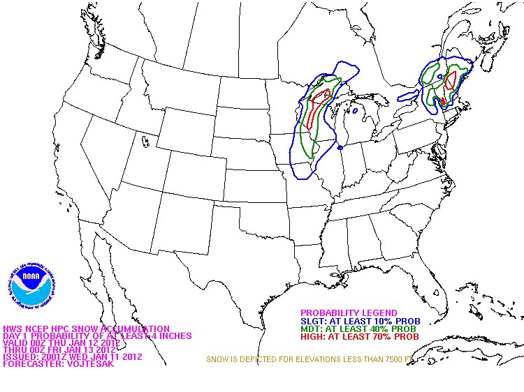

Now that the 1st decent winter storm of the season is less than 12 hours away it's looking more and more impressive! As 2 areas of low pressure combine late tonight we'll see moderate snow start around midnight for most of the area...by the time things wind down Thursday night we'll see 3-5" of snow on the ground through most of the QCA! Strong winds won't help either, with gusts up to 35 mph reducing visibilities even further!
No comments:
Post a Comment