 Tropical Storm Irene formed in the Atlantic Ocean on Saturday (Shown above).
Right now, it's forecasted to affect Puerto Rico, the Dominican Republic, and Haiti over the next 24-48 hours.

The National Hurricane Center (NHC) is thinking that it could be a hurricane when it hits Puerto Rico and the Dominican Republic.
As of Sunday afternoon, the storm had winds of 50 mph and a central low pressure of 999mb. It was moving to the West, Northwest at only 18 mph.
There's still a lot of uncertainty as to where Irene will make landfall in the U.S. and if the storm will be a hurricane or a weak tropical storm when it reaches the states.
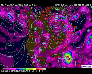
As of Sunday afternoon, forecast models are projecting that Irene could make landfall in Florida as early as Thursday night into Friday morning (GFS Model Shown Below). We'll have to watch and see!


No comments:
Post a Comment