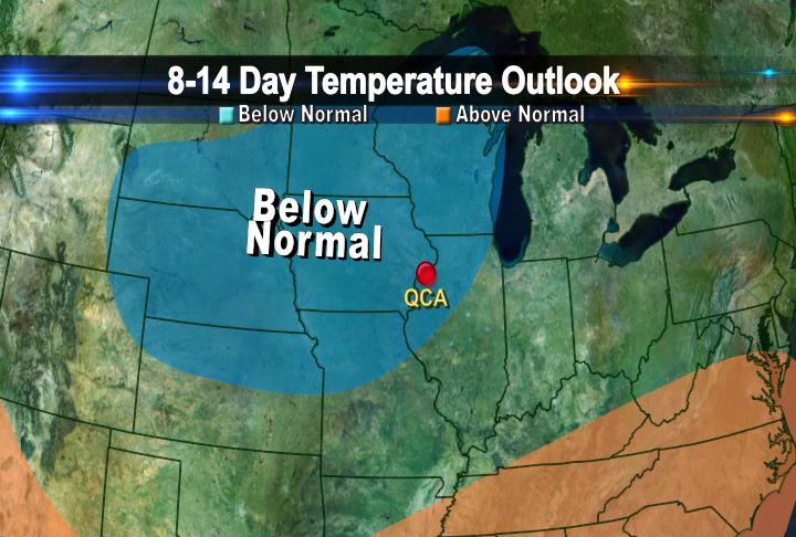
Several big events are coming up in the QCA including the Mississippi Blues Festival, 4th of July, the Firecracker Run, and of course the John Deere Classic. So will the weather cooperate for you to get out and enjoy these events? According to the Climate Prediction Center, temperatures will run below average from the 3rd of July to the 9th. However, there is some good news! Precipitation will be near average during this time. It's still too far out to know exactly what we can expect, but hopefully the weather cooperates so that you can get out of the house and have some summer fun!
Saturday, June 25, 2011
8-14 Day Climate Outlook for the QCA
Several big events are coming up in the QCA including the Mississippi Blues Festival, 4th of July, the Firecracker Run, and of course the John Deere Classic. So will the weather cooperate for you to get out and enjoy these events? According to the Climate Prediction Center, temperatures will run below average from the 3rd of July to the 9th. However, there is some good news! Precipitation will be near average during this time. It's still too far out to know exactly what we can expect, but hopefully the weather cooperates so that you can get out of the house and have some summer fun!
Thursday, June 23, 2011
A Quiet Day Across the Country

We've seen more than enough severe weather reports so far this season, so today's map of storm reports is welcome news! There have been some wind reports, especially throughout the Eastern quarter of the country, but overall things are starting to quiet down! The next chance for storms in the QC arrives Saturday night!
No Record Today...

No new records for us today, but that's not a bad thing! If we were going to set a new record it would have been for the Coolest High Temperature ever on June 23rd! I know it's a bit of a goofy record to keep track of, but it is something meteorologists consider! The record cool high for today is 67°, from back in 1969...and while most of today we have seen temperatures in the 60s for a short while earlier we did hit 71°, so the record is off the table! It looks like we could warm up significantly next week! We'll keep you posted!
And by the way, here are today's hourly temperatures starting at 9am and lasting through 3pm, notice the 71 is nowhere to be found. That means we quickly snuck up to 71 and then quickly faded away!
63
64
67
65
68
66
63
Tuesday, June 21, 2011
Severe T-Storm Watch East of the QCA
Monday, June 20, 2011
Severe Thunderstorm Watch Until 6am

The National Weather Service has issued a severe thunderstorm watch until 6am for all the counties shaded in blue. The storms are moving to the Northeast rather slowly so they will produce heavy rain over a short period of time. Watch out for flash flooding and podding on the roadways. Large hail and strong winds are also possible with these storms.
Because of the heavy rain potential the National Weather Service has also issued a Flash Flood Watch. Details from the NWS are below:
THE NATIONAL WEATHER SERVICE IN QUAD CITIES HAS ISSUED A
* FLASH FLOOD WATCH FOR PORTIONS OF ILLINOIS...SOUTHEAST IOWA
AND NORTHEAST MISSOURI...INCLUDING THE FOLLOWING AREAS...IN
ILLINOIS...HANCOCK...HENDERSON...MCDONOUGH...MERCER AND
WARREN. IN SOUTHEAST IOWA...DES MOINES...HENRY IA...
JEFFERSON...KEOKUK...LEE...LOUISA...VAN BUREN AND WASHINGTON.
IN NORTHEAST MISSOURI...CLARK AND SCOTLAND.
* THROUGH MONDAY AFTERNOON
* THUNDERSTORMS WITH HEAVY RAINFALL OF 1 TO LOCALLY AS MUCH AS 4
INCHES IS LIKELY OVERNIGHT AND MONDAY MORNING. HEAVY RAIN
FALLING ON ALREADY SATURATED SOILS COULD LEAD TO RAPID RUNOFF
AND FLASH FLOODING.
* SIGNIFICANT TO POTENTIALLY MAJOR FLASH FLOODING IS A RISK FOR
SOME LOCATIONS IN FAR SOUTHEAST IOWA...WEST CENTRAL ILLINOIS
AND NORTHEAST MISSOURI.
Sunday, June 19, 2011
Chances for Severe Weather Coming Up...
A warm front will push northward on Monday and provide us with the chance for showers and thunderstorms. As the front moves into the QCA, some of the storms could be strong to severe so the Storm Prediction Center has place our area under a slight risk for severe weather on Monday. We remain under a slight risk for severe weather on Tuesday when a cold front moves into the region from the west. The best chance for storms on Tuesday will be in the late afternoon and early evening.
Saturday, June 18, 2011
Lightning Safety Awareness Week...
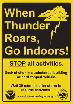
It's lightning safety awareness week from June 19th through June 25th. On average 55people are killed by lightning each year. If you hear thunder it's best to get inside right away because lightning could strike at any moment shortly after you hear thunder. Be sure to stay away from water, trees, and metal objects. For more information on lightning safety check out the National Weather Service's webpage at: www.lightningsafety.noaa.gov
Friday, June 17, 2011
Chances for Storms
A warm front is pushing through the area and the front is not going to move very much over the next few days. Unfortunately the threat of showers and storms will continue for much of the weekend. However, the weekend is not going to be a complete wash out as storms will be scattered and isolated across the area. So while some areas may experience wet weather others may remain dry!
Monday, June 13, 2011
Showers SW of QC...For Now
Sunday, June 12, 2011
Heavy Rainfall in our Future?
There are several chances for showers and thunderstorms over the next few days. Late Monday evening, there is the possibility that some storms that develop could be strong to severe and produce periods of very heavy rain. In fact, forecasters are suggesting that between Monday and Tuesday night some towns around the QCA could pick up over an inch of rain.

Additionally, over the next 6-10 days, the Climate Predicion Center is projecting that our region will see above normal precipitation. This is not good news especially after last week's storms that moved through the area and caused flash flooding in several areas.
Subscribe to:
Posts (Atom)